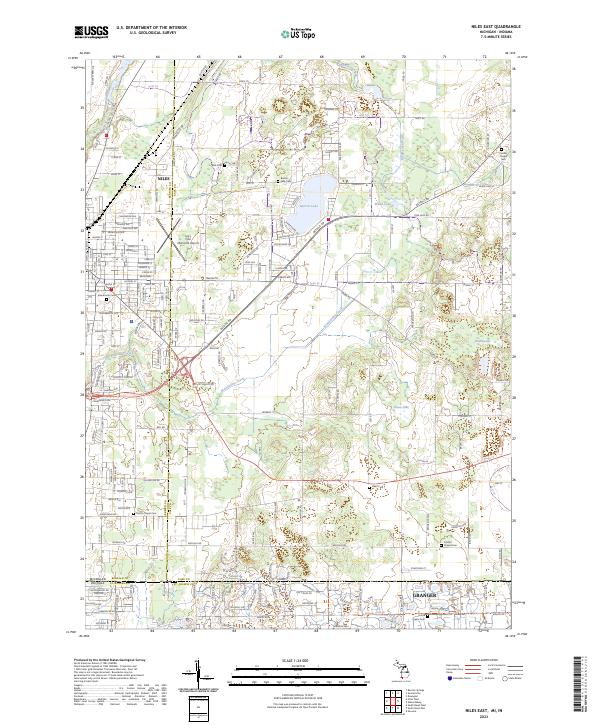
2023 Map of Niles East
USGS Topo · Published 2023About this map
Niles and Granger anchor the landscape where the Michigan-Indiana state line meets the boundary of Berrien and Cass counties. The Dowagiac River and McKinzie Creek flow through the northern reaches, while the southeastern corner is defined by the suburban development of Granger near Goose Lake. This 2023 survey reveals a dense network of local cemeteries that speak to the area's deep roots, including Silverbrook Cem, Truitt Cem, and the historic Smith's Chapel Cem. The transition from the urban grid of Niles to the lakeside communities around Barron Lake illustrates the varied character of this borderland region. In the west, the Jerry Tyler Memorial Airport sits adjacent to the residential expansion of the city, while Brandywine Creek meanders through the central countryside, passing numerous small lakes like Dibble Lake and Mudd Lake.
Find a feature on this map
114 named features on this map. Tap any name to fly to it.
Don’t see what you’re looking for? This feature index may not catch every label — zoom into the map to look around manually.
Map Details
Editions of this 2023 Niles East Map
This is the sole edition of this map. No revisions or reprints were ever made.
Other maps of this area

1927 · Niles
USGS Topo · 1:62,500

1930 · Niles
USGS Topo · 1:62,500

1943 · Niles
USGS Topo · 1:62,500

1945 · Cassopolis
USGS Topo · 1:62,500

1947 · Cassopolis
USGS Topo · 1:62,500

1953 · Chicago
USGS Topo · 1:250,000

1957 · Chicago
USGS Topo · 1:250,000

1958 · South Bend East
USGS Topo · 1:24,000

1958 · South Bend West
USGS Topo · 1:24,000

1958 · Osceola
USGS Topo · 1:24,000