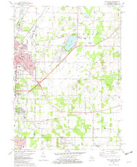
1981 Map of Niles East
USGS Topo · Published 1982About this map
Niles and its eastern outskirts are documented in this early 1980s record of the Michigan-Indiana borderlands. The landscape transitions from the urbanized grids of the city to the lakeside communities and agricultural townships of Howard, Milton, and Harris. Significant aviation infrastructure is present at Tyler Memorial Airport, while the eastern portion of the map is defined by natural water bodies like Barron Lake and Goose Lake. Transportation remains central to the area's identity, with the Amtrak line and Penn Central tracks crossing the terrain alongside early 20th-century remnants like the Old Railroad Grade.
Find a feature on this map
84 named features on this map. Tap any name to fly to it.
Don’t see what you’re looking for? This feature index may not catch every label — zoom into the map to look around manually.
Map Details
Editions of this 1981 Niles East Map
This is the sole edition of this map. No revisions or reprints were ever made.
Other maps of this area

1927 · Niles
USGS Topo · 1:62,500

1930 · Niles
USGS Topo · 1:62,500

1943 · Niles
USGS Topo · 1:62,500

1945 · Cassopolis
USGS Topo · 1:62,500

1947 · Cassopolis
USGS Topo · 1:62,500

1953 · Chicago
USGS Topo · 1:250,000

1957 · Chicago
USGS Topo · 1:250,000

1958 · South Bend East
USGS Topo · 1:24,000

1958 · South Bend West
USGS Topo · 1:24,000

1958 · Osceola
USGS Topo · 1:24,000