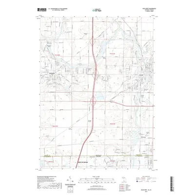
2019 Map of Niles West
USGS Topo · Published 2019About this map
The Saint Joseph River serves as the central artery for this borderland corridor, winding between the cities of Buchanan and Niles. The landscape is a mosaic of mid-sized industrial centers and smaller pockets of heritage, such as Bertrand, where the Bertrand Protestant Cem and Saint Josephs Cem sit near the riverbanks. The survey captures a significant concentration of local burial sites and memorials, including the Father Allouez Grave Site and the Ann Beason Purdy Groves memorial area. North of the state line, the terrain around Portage Prairie transitions from residential grid to more open agricultural land, marked by landmarks like Wolverton's Field and the Orchard Hills Country Club Cem. The presence of several river islands, such as Debs Island and Batchelors Island, highlights the shifting natural course of the waterway amidst the surrounding development of South Bend to the south.
Find a feature on this map
206 named features on this map. Tap any name to fly to it.
Don’t see what you’re looking for? This feature index may not catch every label — zoom into the map to look around manually.
Map Details
Editions of this 2019 Niles West Map
This is the sole edition of this map. No revisions or reprints were ever made.
Other maps of this area

1927 · Niles
USGS Topo · 1:62,500

1930 · Niles
USGS Topo · 1:62,500

1943 · Niles
USGS Topo · 1:62,500

1945 · Cassopolis
USGS Topo · 1:62,500

1947 · Cassopolis
USGS Topo · 1:62,500

1953 · Chicago
USGS Topo · 1:250,000

1957 · Chicago
USGS Topo · 1:250,000

1958 · South Bend East
USGS Topo · 1:24,000

1958 · South Bend West
USGS Topo · 1:24,000

1958 · Lydick
USGS Topo · 1:24,000