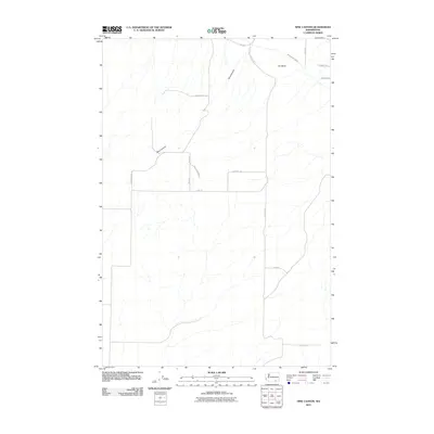
2011 Map of Nine Canyon
USGS Topo · Published 2011About this map
Nine Canyon carves through this high desert portion of Benton County, defining the drainage patterns of a landscape increasingly shaped by 21st-century agricultural and infrastructure development. The Division Four Canal cuts across the northern landscape near The Butte, illustrating the vital role of irrigation in the Columbia Basin's arid environment. The road network, including S Nine Canyon Rd and Canyon River Rd, traces the contours of the coulees and plateaus, while family-named routes like E Lower Blair Rd and Les Blair Rd suggest the enduring presence of local landholders. This map shows a transition from open range to a more structured rural grid, where landmarks like Albright Rd and E Kirk Rd connect isolated homesteads and ranching operations across the undulating terrain.
Find a feature on this map
16 named features on this map. Tap any name to fly to it.
Don’t see what you’re looking for? This feature index may not catch every label — zoom into the map to look around manually.
Map Details
Editions of this 2011 Nine Canyon Map
This is the sole edition of this map. No revisions or reprints were ever made.
Other maps of this area

1908 · Umatilla
USGS Topo · 1:125,000

1915 · Wallulah
USGS Topo · 1:96,000

1917 · Pasco
USGS Topo · 1:125,000

1918 · Wallula
USGS Topo · 1:125,000

1935 · Pendleton
USGS Topo · 1:125,000

1953 · Pendleton
USGS Topo · 1:250,000

1953 · Walla Walla
USGS Topo · 1:250,000

1956 · Pendleton
USGS Topo · 1:250,000

1958 · Walla Walla
USGS Topo · 1:250,000

1962 · Hat Rock
USGS Topo · 1:24,000