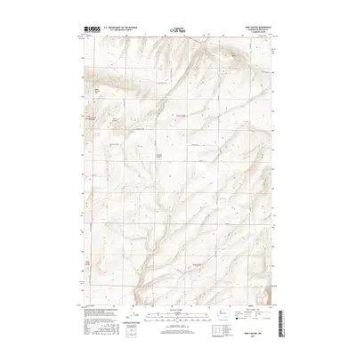
2017 Map of Nine Canyon
USGS Topo · Published 2017About this map
The Horse Heaven Hills dominate this portion of the Columbia Basin, defined by deep drainage systems such as Nine Canyon and Switzler Canyon. The terrain reflects a landscape of high ridges and agricultural valleys, where the Division Four Canal provides critical water management for the arid surroundings. This 2017 survey shows a network of rural roads that follow the natural topography, including S Nine Canyon Rd and S Upper Blair Rd, which connect the high plateaus to the lower reaches. Distinctive landmarks like The Butte rise above the undulating hills, providing clear navigational points in a region largely dedicated to open space and farming. The map effectively documents the transition from the high ridges of the Horse Heaven Hills down toward the irrigation networks that sustain the area.
Find a feature on this map
23 named features on this map. Tap any name to fly to it.
Don’t see what you’re looking for? This feature index may not catch every label — zoom into the map to look around manually.
Map Details
Editions of this 2017 Nine Canyon Map
This is the sole edition of this map. No revisions or reprints were ever made.
Other maps of this area

1908 · Umatilla
USGS Topo · 1:125,000

1915 · Wallulah
USGS Topo · 1:96,000

1917 · Pasco
USGS Topo · 1:125,000

1918 · Wallula
USGS Topo · 1:125,000

1935 · Pendleton
USGS Topo · 1:125,000

1953 · Pendleton
USGS Topo · 1:250,000

1953 · Walla Walla
USGS Topo · 1:250,000

1956 · Pendleton
USGS Topo · 1:250,000

1958 · Walla Walla
USGS Topo · 1:250,000

1962 · Hat Rock
USGS Topo · 1:24,000