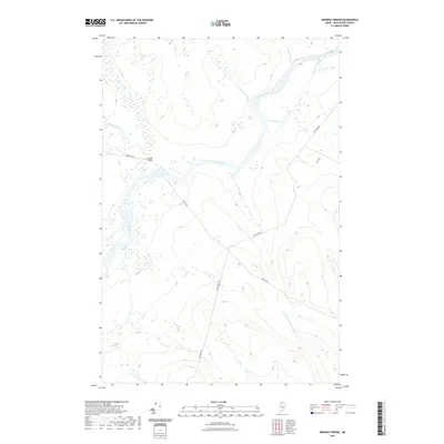
2021 Map of Ninemile Bridge
USGS Topo · Published 2021About this map
The Saint John River dictates the landscape of this remote northern Maine territory, serving as the primary corridor through which numerous tributaries drain the Aroostook County forest. Ninemile Bridge stands as a rare human waypoint in this expansive timberland, where the river meets Ninemile Brook and a network of logging infrastructure. The map reveals the intricate drainage patterns of the North Woods, with named waterways like Conners Brook, Houlton Brook, and the isolated Ed Jones Pond punctuating the dense canopy.
Find a feature on this map
13 named features on this map. Tap any name to fly to it.
Don’t see what you’re looking for? This feature index may not catch every label — zoom into the map to look around manually.
Map Details
Editions of this 2021 Ninemile Bridge Map
This is the sole edition of this map. No revisions or reprints were ever made.
Other maps of this area

1954 · Presque Isle
USGS Topo · 1:250,000

1955 · Depot Lake
USGS Topo · 1:62,500

1955 · Beaver Pond
USGS Topo · 1:62,500

1955 · Clayton Lake
USGS Topo · 1:62,500

1955 · Seven Islands
USGS Topo · 1:62,500

1958 · Presque Isle
USGS Topo · 1:250,000

1960 · Presque Isle
USGS Topo · 1:250,000

1976 · Seven Islands
USGS Topo · 1:24,000

1976 · Depot Lake
USGS Topo · 1:24,000
1977 · Houlton Pond
USGS Topo · 1:24,000