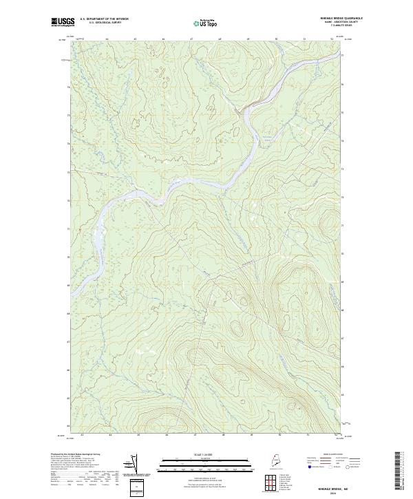
2024 Map of Ninemile Bridge
USGS Topo · Published 2024About this map
The Saint John River carves a dominant path through this portion of the North Maine Woods, serving as the primary geographic corridor in an area otherwise defined by timber management and remote waterways. This 2024 landscape is primarily accessed via industrial thoroughfares like Realty Rd and Boulevard Rd, which support the regional logging economy. Smaller water bodies and drainages, such as the family-named Ed Jones Pond and the sequential Ninemile Brook and Sixmile Brook, flow into the main river channel, illustrating the intricate drainage network of Aroostook County. The presence of Number 1 Rd and Thi 10 Rd highlights the long-standing network of forest roads that have replaced earlier river-based transport methods for the timber industry.
Find a feature on this map
13 named features on this map. Tap any name to fly to it.
Don’t see what you’re looking for? This feature index may not catch every label — zoom into the map to look around manually.
Map Details
Editions of this 2024 Ninemile Bridge Map
This is the sole edition of this map. No revisions or reprints were ever made.
Other maps of this area

1954 · Presque Isle
USGS Topo · 1:250,000

1955 · Depot Lake
USGS Topo · 1:62,500

1955 · Beaver Pond
USGS Topo · 1:62,500

1955 · Clayton Lake
USGS Topo · 1:62,500

1955 · Seven Islands
USGS Topo · 1:62,500

1958 · Presque Isle
USGS Topo · 1:250,000

1960 · Presque Isle
USGS Topo · 1:250,000

1976 · Seven Islands
USGS Topo · 1:24,000

1976 · Depot Lake
USGS Topo · 1:24,000
1977 · Houlton Pond
USGS Topo · 1:24,000