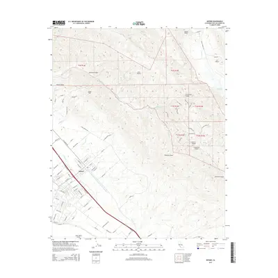
2015 Map of Nipomo
USGS Topo · Published 2015About this map
Nipomo serves as the primary residential hub on this Central Coast quadrangle, situated at the base of the Santa Maria Valley’s northern slopes. The landscape transitions quickly from the town's street grid into the steep, wrinkled terrain of the southern Coast Ranges. Significant drainage systems such as Nipomo Cr and Deleissigues Cr carve through the foothills, while the northeast corner of the map is dominated by the Huasna Valley and the waters of Twitchell Reservoir on the Santa Maria River.
Find a feature on this map
87 named features on this map. Tap any name to fly to it.
Don’t see what you’re looking for? This feature index may not catch every label — zoom into the map to look around manually.
Map Details
Editions of this 2015 Nipomo Map
This is the sole edition of this map. No revisions or reprints were ever made.
Other maps of this area

1897 · Arroyo Grande
USGS Topo · 1:62,500

1900 · San Luis
USGS Topo · 1:125,000

1905 · Guadalupe
USGS Topo · 1:125,000

1905 · Lompoc
USGS Topo · 1:125,000

1922 · Nipomo
USGS Topo · 1:62,500

1942 · Guadalupe
USGS Topo · 1:125,000

1942 · Lompoc
USGS Topo · 1:125,000

1942 · Arroyo Grande
USGS Topo · 1:62,500

1942 · Santa Maria
USGS Topo · 1:62,500

1942 · Point Sal
USGS Topo · 1:62,500