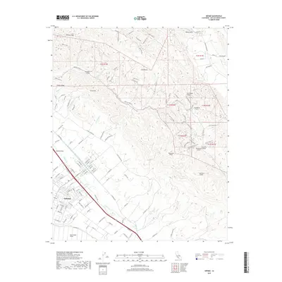
2018 Map of Nipomo
USGS Topo · Published 2018About this map
Nipomo serves as the focal point of this 2018 survey, situated where the southern reaches of the Nipomo Valley meet the northern edge of the Santa Maria Valley. The landscape is defined by a series of rugged canyons and ridges, including Newsom Ridge and Temettate Ridge, which drain toward a complex network of creeks like Nipomo Creek and Deleissigues Creek. This era of the region’s development is marked by the presence of the Governor Edmund G Brown Coastal Branch California Aqueduct, which cuts diagonally through the foothills.
Find a feature on this map
129 named features on this map. Tap any name to fly to it.
Don’t see what you’re looking for? This feature index may not catch every label — zoom into the map to look around manually.
Map Details
Editions of this 2018 Nipomo Map
This is the sole edition of this map. No revisions or reprints were ever made.
Other maps of this area

1897 · Arroyo Grande
USGS Topo · 1:62,500

1900 · San Luis
USGS Topo · 1:125,000

1905 · Guadalupe
USGS Topo · 1:125,000

1905 · Lompoc
USGS Topo · 1:125,000

1922 · Nipomo
USGS Topo · 1:62,500

1942 · Guadalupe
USGS Topo · 1:125,000

1942 · Lompoc
USGS Topo · 1:125,000

1942 · Arroyo Grande
USGS Topo · 1:62,500

1942 · Santa Maria
USGS Topo · 1:62,500

1942 · Point Sal
USGS Topo · 1:62,500