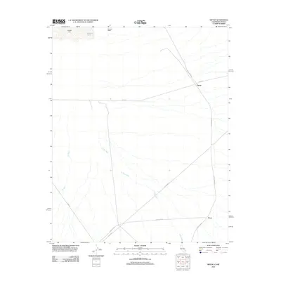
2012 Map of Nipton
USGS Topo · Published 2012About this map
Nipton stands as a primary desert crossroads in this high-altitude corner of San Bernardino County. Located within the Ivanpah Valley, this landscape is defined by the vast drainage networks of Willow Wash and Oro Wash, which flow toward the dry basin of Ivanpah Lake. The map captures the remote settlement of Moore to the southeast, connected to the larger community by Nipton Moore Rd. The presence of Mesquite Holes near the lake bed suggests the critical location of seasonal water sources in this arid environment. Transportation corridors like Nipton Rd and Ivanpah Rd serve as the lifeblood of this region, tracing historical routes through the Mojave Desert. This survey provides a precise look at the land before major shifts in desert infrastructure, focusing on the sparse settlements and natural water features that have sustained travel in this valley for decades.
Find a feature on this map
13 named features on this map. Tap any name to fly to it.
Don’t see what you’re looking for? This feature index may not catch every label — zoom into the map to look around manually.
Map Details
Editions of this 2012 Nipton Map
This is the sole edition of this map. No revisions or reprints were ever made.
Other maps of this area

1910 · Ivanpah
USGS Topo · 1:250,000

1912 · Ivanpah
USGS Topo · 1:250,000

1942 · Ivanpah
USGS Topo · 1:250,000

1947 · Kingman
USGS Topo · 1:250,000

1948 · Kingman
USGS Topo · 1:250,000

1954 · Kingman
USGS Topo · 1:250,000

1955 · Kingman
USGS Topo · 1:250,000

1955 · Roach Lake
USGS Topo · 1:62,500

1956 · Ivanpah
USGS Topo · 1:62,500
1956 · Crescent Peak
USGS Topo · 1:62,500