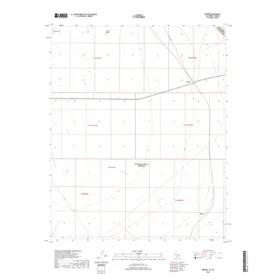
2018 Map of Nipton
USGS Topo · Published 2018About this map
Nipton stands as a primary focal point at the junction of rail lines and Highway 164, marking a key transit point in the high desert near the California-Nevada border. This landscape is defined by the broad, arid expanse of the Ivanpah Valley, where the ephemeral Ivanpah Lake and the curious Mesquite Holes suggest the complex hydrology of the Mojave Desert. The southern portion of the map transitions into the protected lands of the Mojave National Preserve, showing the modern boundaries of this desert conservation area.
Find a feature on this map
18 named features on this map. Tap any name to fly to it.
Don’t see what you’re looking for? This feature index may not catch every label — zoom into the map to look around manually.
Map Details
Editions of this 2018 Nipton Map
This is the sole edition of this map. No revisions or reprints were ever made.
Other maps of this area

1910 · Ivanpah
USGS Topo · 1:250,000

1912 · Ivanpah
USGS Topo · 1:250,000

1942 · Ivanpah
USGS Topo · 1:250,000

1947 · Kingman
USGS Topo · 1:250,000

1948 · Kingman
USGS Topo · 1:250,000

1954 · Kingman
USGS Topo · 1:250,000

1955 · Kingman
USGS Topo · 1:250,000

1955 · Roach Lake
USGS Topo · 1:62,500

1956 · Ivanpah
USGS Topo · 1:62,500
1956 · Crescent Peak
USGS Topo · 1:62,500