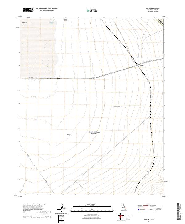
2021 Map of Nipton
USGS Topo · Published 2021About this map
Nipton serves as a focal point in this high-desert landscape, situated along the corridor of Nipton Rd near the California-Nevada border. The terrain is characterized by the broad expanse of the Ivanpah Valley and the dry basin of Ivanpah Lake, which transitions into the protected lands of the Mojave National Preserve. This 2021 survey illustrates the modern configuration of this remote outpost, which has historically served as a gateway between the desert interior and regional transport routes. Further south, the map identifies the location of Moore, another point of interest along the rail and road network that threads through the Mojave Desert. Notable landmarks such as Mesquite Holes and the intersection of Ivanpah Rd and Nipton Desert Rd highlight the scattered but significant waypoints that define navigation in this arid environment.
Find a feature on this map
17 named features on this map. Tap any name to fly to it.
Don’t see what you’re looking for? This feature index may not catch every label — zoom into the map to look around manually.
Map Details
Editions of this 2021 Nipton Map
This is the sole edition of this map. No revisions or reprints were ever made.
Other maps of this area

1910 · Ivanpah
USGS Topo · 1:250,000

1912 · Ivanpah
USGS Topo · 1:250,000

1942 · Ivanpah
USGS Topo · 1:250,000

1947 · Kingman
USGS Topo · 1:250,000

1948 · Kingman
USGS Topo · 1:250,000

1954 · Kingman
USGS Topo · 1:250,000

1955 · Kingman
USGS Topo · 1:250,000

1955 · Roach Lake
USGS Topo · 1:62,500

1956 · Ivanpah
USGS Topo · 1:62,500
1956 · Crescent Peak
USGS Topo · 1:62,500