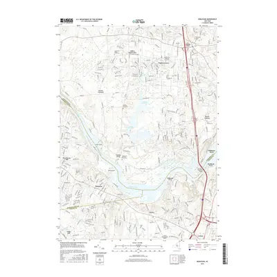
2016 Map of Niskayuna
USGS Topo · Published 2016About this map
Vischer Ferry and Dunsbach Ferry anchor a landscape defined by the winding course of the Mohawk River, where the convergence of Saratoga, Albany, and Schenectady counties creates a complex network of suburban and historical intersections. The 2016 topography reveals a region in transition, balancing established residential corridors like Clifton Park and Latham with significant water infrastructure at the Colonie Reservoir. Local history is deeply embedded in the land through numerous religious landmarks, including the Amity Dutch Reformed Church and the Grooms Methodist Church, each accompanied by their respective burial grounds. Transportation remains a central theme, as the modern expanse of the Thaddeus Kosciuszko Bridge contrasts with the older river crossings. Significant landmarks such as the Albany International Airport and Goat Island further illustrate the diverse land use in this Capital District corridor, providing a clear record of the area's development and natural geography.
Find a feature on this map
242 named features on this map. Tap any name to fly to it.
Don’t see what you’re looking for? This feature index may not catch every label — zoom into the map to look around manually.
Map Details
Editions of this 2016 Niskayuna Map
This is the sole edition of this map. No revisions or reprints were ever made.
Other maps of this area

1893 · Cohoes
USGS Topo · 1:62,500

1893 · Troy
USGS Topo · 1:62,500

1893 · Schenectady
USGS Topo · 1:62,500

1893 · Albany
USGS Topo · 1:62,500

1895 · Troy
USGS Topo · 1:62,500

1895 · Cohoes
USGS Topo · 1:62,500

1895 · Albany
USGS Topo · 1:62,500

1895 · Schenectady
USGS Topo · 1:62,500

1898 · Schenectady
USGS Topo · 1:62,500

1898 · Albany
USGS Topo · 1:62,500