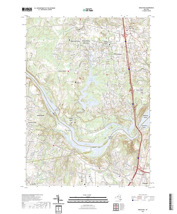
2023 Map of Niskayuna
USGS Topo · Published 2023About this map
The Mohawk River carves a deep valley through this landscape, serving as the historical boundary between Saratoga, Schenectady, and Albany counties. Along its banks, the remnants of the region's river-dependent past are visible at Vischer Ferry and Dunsbach Ferry, where the shoreline transitions into the residential expansion of Niskayuna and Latham. The map details numerous island features such as Goat Island and Niska Island that sit within the widening river channel.
Find a feature on this map
47 named features on this map. Tap any name to fly to it.
Don’t see what you’re looking for? This feature index may not catch every label — zoom into the map to look around manually.
Map Details
Editions of this 2023 Niskayuna Map
This is the sole edition of this map. No revisions or reprints were ever made.
Other maps of this area

1893 · Cohoes
USGS Topo · 1:62,500

1893 · Troy
USGS Topo · 1:62,500

1893 · Schenectady
USGS Topo · 1:62,500

1893 · Albany
USGS Topo · 1:62,500

1895 · Troy
USGS Topo · 1:62,500

1895 · Cohoes
USGS Topo · 1:62,500

1895 · Albany
USGS Topo · 1:62,500

1895 · Schenectady
USGS Topo · 1:62,500

1898 · Schenectady
USGS Topo · 1:62,500

1898 · Albany
USGS Topo · 1:62,500