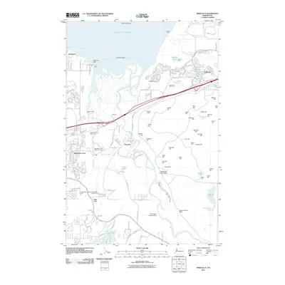
2011 Map of Nisqually
USGS Topo · Published 2011About this map
The Nisqually River delta dominates this 2011 landscape, where the river meets the Nisqually Reach of the Puget Sound. This environment is defined by its transition from the tidal Nisqually Flats to the upland bluffs of the Eighteenth Infantry Bluff and Thirty-eight Infantry Bluff. Residential expansion is evident in the planned streets of DuPont and smaller clusters like Mushroom Corner and Beachcrest. The map documents a complex water management system, including the Nisqually Trout Farm Dam and the Medicine Creek Reservoir Dam, highlighting the intersection of natural hydrology and local industry. To the east, numerous named summits such as Meade Hill and Foster Hill provide topographic variety near the BNSF Railway corridor, while the southern portion of the sheet is anchored by the irregular shoreline of Lake Saint Clair and the community of Saint Clair.
Find a feature on this map
139 named features on this map. Tap any name to fly to it.
Don’t see what you’re looking for? This feature index may not catch every label — zoom into the map to look around manually.
Map Details
Editions of this 2011 Nisqually Map
This is the sole edition of this map. No revisions or reprints were ever made.
Other maps of this area

1916 · Chehalis
USGS Topo · 1:125,000

1937 · Olympia
USGS Topo · 1:62,500

1940 · Tenino
USGS Topo · 1:62,500

1940 · Anderson Island
USGS Topo · 1:62,500

1944 · Tenino
USGS Topo · 1:62,500

1944 · Yelm
USGS Topo · 1:62,500

1948 · Anderson Island
USGS Topo · 1:62,500

1948 · Fort Lewis
USGS Topo · 1:24,000

1948 · Nisqually
USGS Topo · 1:24,000

1948 · Anderson Island
USGS Topo · 1:24,000