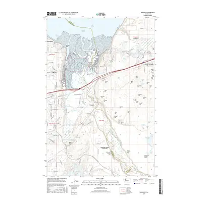
2017 Map of Nisqually
USGS Topo · Published 2017About this map
Nisqually Reach and the northern tip of the Nisqually River delta form the heart of this landscape, where the saltwater of Puget Sound meets a complex network of marshes and bluffs. The area is defined by the intersection of the Nisqually Indian Community and the massive military installation at Fort Lewis, which occupies the eastern uplands. Significant hydrological features include McAllister Springs and the expansive Lake Saint Clair, while the land is punctuated by numerous named hills such as Hoffman Hill and Jansen Hill. The map also traces the Old Pacific Hwy corridor as it passes through the settlement of Nisqually. The presence of features like Thirty-eight Infantry Bluff and Eighteenth Infantry Bluff reflects the long-standing military presence on the bluffs overlooking the river valley.
Find a feature on this map
154 named features on this map. Tap any name to fly to it.
Don’t see what you’re looking for? This feature index may not catch every label — zoom into the map to look around manually.
Map Details
Editions of this 2017 Nisqually Map
This is the sole edition of this map. No revisions or reprints were ever made.
Other maps of this area

1916 · Chehalis
USGS Topo · 1:125,000

1937 · Olympia
USGS Topo · 1:62,500

1940 · Tenino
USGS Topo · 1:62,500

1940 · Anderson Island
USGS Topo · 1:62,500

1944 · Tenino
USGS Topo · 1:62,500

1944 · Yelm
USGS Topo · 1:62,500

1948 · Anderson Island
USGS Topo · 1:62,500

1948 · Fort Lewis
USGS Topo · 1:24,000

1948 · Nisqually
USGS Topo · 1:24,000

1948 · Anderson Island
USGS Topo · 1:24,000