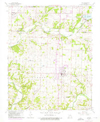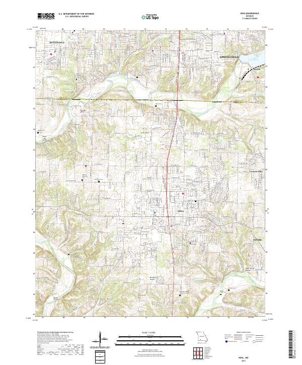
2021 Map of Nixa
USGS Topo · Published 2021About this map
The James River and Finley Creek dominate this landscape south of Springfield, where residential growth from Nixa and Ozark meets established rural landmarks. Numerous family burial grounds and memorial sites are found throughout the area, including Bledsoe Memorial Cem, Patterson Cem, and Rosedale Valley Memorial Gardens. Historic crossings like Nelson Mill Bridge and Frazier Bridge provide insight into the local transportation network that developed around the river valleys. The terrain is characterized by distinctive features such as Saunders Valley, Avin Sink, and McCafferty Hollow, illustrating the region's complex karst topography. Smaller springs like Indian Spring and Blue Spring feed into the larger water systems, while the northern edge of the map shows the industrial and recreational reach of Lake Springfield and the modern suburb of Fremont Hills.
Find a feature on this map
100 named features on this map. Tap any name to fly to it.
Don’t see what you’re looking for? This feature index may not catch every label — zoom into the map to look around manually.
Map Details
Editions of this 2021 Nixa Map
This is the sole edition of this map. No revisions or reprints were ever made.