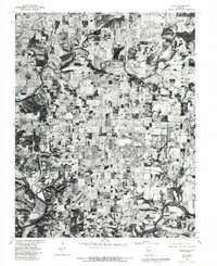
1979 Map of Nixa
USGS Topo · Published 1981About this map
Nixa and its surrounding agricultural landscape are captured in this orthophotograph, providing a clear visual record of Christian County's transition as the 1970s concluded. The imagery reveals a dense patchwork of small farms and developing residential corridors along the primary north-south transit routes. To the north, the winding James River snakes across the terrain, feeding into the northern reaches of Lake Springfield. This specific map format combines aerial photography with established land lines from the 1960s, offering a unique layer of data for understanding how the rural edges of Battlefield and the small settlement at Kissick were evolving before the modern suburban expansion of the Springfield area. To the southeast, the course of Finley Creek cuts through more wooded, dissected topography, contrasting with the flatter, cleared fields that dominate the central part of the quadrangle.
Find a feature on this map
6 named features on this map. Tap any name to fly to it.
Don’t see what you’re looking for? This feature index may not catch every label — zoom into the map to look around manually.
Map Details
Editions of this 1979 Nixa Map
This is the sole edition of this map. No revisions or reprints were ever made.
Other maps of this area

1884 · Springfield
USGS Topo · 1:125,000

1886 · Springfield
USGS Topo · 1:125,000

1907 · Forsyth
USGS Topo · 1:125,000

1935 · Springfield
USGS Topo · 1:24,000

1936 · Brookline
USGS Topo · 1:24,000

1937 · Galloway
USGS Topo · 1:24,000

1937 · Ozark
USGS Topo · 1:48,000

1943 · Ozark
USGS Topo · 1:62,500

1945 · Harrison
USGS Topo · 1:250,000

1945 · Ozark
USGS Topo · 1:62,500