
1937 Map of Nixonville
USGS Topo · Published 1937About this map
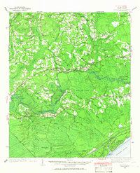
Nixonville and Grahamville anchor this 1937 landscape defined by the intricate water systems of Horry County. The map documents an era of river-dependent transport transitioning to rail, evidenced by the numerous landings along the Waccamaw River like Pinetree Ldg and Evans Ldg, alongside the Atlantic Coast Line railroad near Gurley. A significant detail is the notation of Hardees Ferry (Abandoned), marking a shift in local transit patterns.
Find a feature on this map
127 named features on this map. Tap any name to fly to it.
Don’t see what you’re looking for? This feature index may not catch every label — zoom into the map to look around manually.
Map Details
Editions of this 1937 Nixonville Map
2 editions found
Other maps of this area

1937 · Myrtle Beach
USGS Topo · 1:48,000

1940 · Myrtle Beach
USGS Topo · 1:62,500

1942 · Nixonville
USGS Topo · 1:62,500

1943 · Pireway
USGS Topo · 1:31,680

1943 · Wampee
USGS Topo · 1:24,000

1943 · Bucksville
USGS Topo · 1:24,000

1943 · Adrian
USGS Topo · 1:24,000

1943 · Conway
USGS Topo · 1:24,000

1944 · Longs
USGS Topo · 1:31,680

1944 · Adrian
USGS Topo · 1:31,680