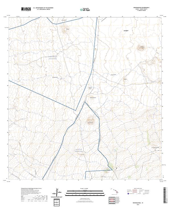
2024 Map of Nohonaohae
USGS Topo · Published 2024About this map
The Pohakuloa Training Area occupies a significant portion of this high-altitude landscape on the Island of Hawai‘i, where military infrastructure and transport corridors intersect with traditional Hawaiian geography. The infrastructure is anchored by the convergence of the Hawaii Belt Rd and Saddle Rd, highlighting the area's role as a vital interior junction. Local topographic landmarks such as Nohonaohae, Holoholokū, and Puu Keanahuehue rise above the surrounding terrain, while deep drainage features like Kamakao Gulch and Kemole Gulch define the watershed patterns.
Find a feature on this map
21 named features on this map. Tap any name to fly to it.
Don’t see what you’re looking for? This feature index may not catch every label — zoom into the map to look around manually.
Map Details
Editions of this 2024 Nohonaohae Map
This is the sole edition of this map. No revisions or reprints were ever made.
Other maps of this area

1913 · Kohala
USGS Topo · 1:62,500

1916 · Kohala
USGS Topo · 1:62,500

1916 · Waipio
USGS Topo · 1:62,500

1928 · Puako
USGS Topo · 1:62,500

1954 · Hawaii North
USGS Topo · 1:250,000

1956 · Puu Hinai
USGS Topo · 1:24,000

1956 · Kamuela
USGS Topo · 1:24,000

1956 · Keamuku
USGS Topo · 1:24,000

1956 · Nohonaohae
USGS Topo · 1:24,000

1956 · Makahalau
USGS Topo · 1:24,000