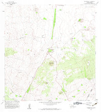
1982 Map of Nohonaohae
USGS Topo · Published 1982About this map
The dry leeward slopes of the South Kohala District and Hamakua District define this landscape, where volcanic cinder cones rise above a network of gulches and ranching infrastructure. Centered on the Waikoloa region in the early 1980s, the map illustrates the critical transportation hub at Saddle Road Junction, where the arterial Saddle Road meets the highway near the Waimea-Kohala Airport.
Find a feature on this map
25 named features on this map. Tap any name to fly to it.
Don’t see what you’re looking for? This feature index may not catch every label — zoom into the map to look around manually.
Map Details
Editions of this 1982 Nohonaohae Map
This is the sole edition of this map. No revisions or reprints were ever made.
Other maps of this area

1913 · Kohala
USGS Topo · 1:62,500

1916 · Kohala
USGS Topo · 1:62,500

1916 · Waipio
USGS Topo · 1:62,500

1928 · Puako
USGS Topo · 1:62,500

1954 · Hawaii North
USGS Topo · 1:250,000

1956 · Puu Hinai
USGS Topo · 1:24,000

1956 · Kamuela
USGS Topo · 1:24,000

1956 · Keamuku
USGS Topo · 1:24,000

1956 · Nohonaohae
USGS Topo · 1:24,000

1956 · Makahalau
USGS Topo · 1:24,000