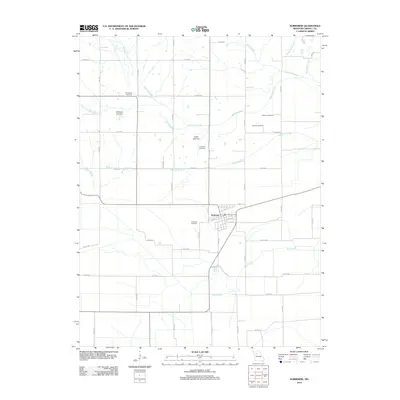
2012 Map of Norborne
USGS Topo · Published 2012About this map
Norborne serves as the central hub of this Missouri landscape, situated within a dense network of county roads and vital waterways. The town layout is defined by streets like N Oak St and Park St, surrounded by a significant concentration of local burial grounds including Fairhaven Cemetery, Lutheran Cemetery, and Providence Cemetery. These sites, alongside others like German Cemetery and Cloudis Cemetery, provide essential records for genealogical research in this part of Carroll County.
Find a feature on this map
46 named features on this map. Tap any name to fly to it.
Don’t see what you’re looking for? This feature index may not catch every label — zoom into the map to look around manually.
Map Details
Editions of this 2012 Norborne Map
This is the sole edition of this map. No revisions or reprints were ever made.
Other maps of this area

1889 · Lexington
USGS Topo · 1:125,000

1949 · Lexington East
USGS Topo · 1:24,000

1950 · Lexington East
USGS Topo · 1:24,000

1950 · Dover
USGS Topo · 1:24,000
1951 · Dover
USGS Topo · 1:24,000

1951 · Waverly
USGS Topo · 1:24,000

1953 · Moberly
USGS Topo · 1:250,000

1954 · Moberly
USGS Topo · 1:250,000
1956 · Carrollton West
USGS Topo · 1:24,000

1957 · Moberly
USGS Topo · 1:250,000