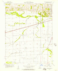
1956 Map of Carrollton West
USGS Topo · Published 1957About this map
The bottomlands and bluffs west of Carrollton reveal a landscape defined by the drainage of Wakenda Creek and the intricate network of the Atchison Topeka and Santa Fe and Wabash RR. This mid-century survey captures the rural character of Carroll County, where the agricultural flats are segmented by hydrological features like Booker Slough and the Sugartree Ditch. The map provides a clear look at the intersection of rail infrastructure and small-scale settlements at WB Junction and Palemon, illustrating the transit-dependent nature of Missouri's river counties in this era.
Find a feature on this map
28 named features on this map. Tap any name to fly to it.
Don’t see what you’re looking for? This feature index may not catch every label — zoom into the map to look around manually.
Map Details
Editions of this 1956 Carrollton West Map
2 editions found
Other maps of this area

1889 · Lexington
USGS Topo · 1:125,000

1890 · Marshall
USGS Topo · 1:125,000

1892 · Marshall
USGS Topo · 1:125,000

1901 · Marshall
USGS Topo · 1:125,000

1950 · Dover
USGS Topo · 1:24,000
1951 · Dover
USGS Topo · 1:24,000

1951 · Carrollton East
USGS Topo · 1:24,000
1951 · Standish
USGS Topo · 1:24,000

1951 · Waverly
USGS Topo · 1:24,000

1953 · Moberly
USGS Topo · 1:250,000