
1962 Map of Norfleet
USGS Topo · Published 1964About this map
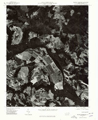
The Roanoke River snakes across this coastal plain landscape, defining the borders where Halifax, Northampton, and Bertie counties meet. In the early 1960s, the area remained a dense network of wetlands and small agricultural settlements, with Cypress Swamp and Quinine Swamp filling the low-lying reaches between the river and the higher ground of Rich Square and Roxobel. The map preserves the location of numerous family-named landmarks and local institutions, including Sandy Run Ch and William Chapel, alongside family burial grounds such as Bell Cem and Hall Cem. Two major rail corridors, the Seaboard Air Line and the Atlantic Coast Line, cut through the terrain, intersecting near the small community of Norfleet. These tracks, coupled with landings like Fox Bank, illustrate a landscape still deeply tied to riverine and rail-based transport for its timber and agricultural output.
Find a feature on this map
32 named features on this map. Tap any name to fly to it.
Don’t see what you’re looking for? This feature index may not catch every label — zoom into the map to look around manually.
Map Details
Editions of this 1962 Norfleet Map
This is the sole edition of this map. No revisions or reprints were ever made.
Other maps of this area

1953 · Norfolk
USGS Topo · 1:250,000

1962 · Palmyra
USGS Topo · 1:24,000

1962 · Scotland Neck
USGS Topo · 1:24,000

1962 · Hobgood
USGS Topo · 1:24,000

1972 · Woodville
USGS Topo · 1:24,000

1973 · Kelford
USGS Topo · 1:24,000

1974 · Boones Crossroads
USGS Topo · 1:24,000

1974 · Rich Square
USGS Topo · 1:24,000

1977 · Woodland
USGS Topo · 1:24,000
1977 · Boones Crossroads
USGS Topo · 1:24,000