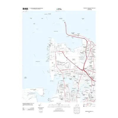
2013 Map of Norfolk North
USGS Topo · Published 2013About this map
Norfolk Naval Station (Chambers Field) dominates the waterfront in this detailed 2013 survey of the Virginia coastline. The map illustrates a complex industrial and military landscape, where the Elizabeth River meets Hampton Roads. The massive infrastructure of the Norfolk International Terminals and the extensive pier system at Sewells Point contrast with established residential neighborhoods like Lochhaven, Meadowbrook, and Edgewater. The transportation network is a central focus, featuring the Hampton Roads Bridge Tunnel and the Old Point Ferry crossing to the north. Further inland, the map captures the dense suburban growth of the early 21st century around Wards Corner and the numerous inlets of the Lafayette River. Along the northern shore, Willoughby Spit and Willoughby Beach provide a residential buffer against the Chesapeake Bay, while the southern portion reveals the heavy rail presence of the Norfolk Southern Terminal Dr near Lamberts Point.
Find a feature on this map
112 named features on this map. Tap any name to fly to it.
Don’t see what you’re looking for? This feature index may not catch every label — zoom into the map to look around manually.
Map Details
Editions of this 2013 Norfolk North Map
This is the sole edition of this map. No revisions or reprints were ever made.
Other maps of this area

1907 · Norfolk
USGS Topo · 1:125,000

1907 · Hampton
USGS Topo · 1:62,500

1918 · Cape Henry
USGS Topo · 1:62,500

1919 · Cape Henry
USGS Topo · 1:62,500

1921 · Newport News
USGS Topo · 1:62,500

1943 · Richmond
USGS Topo · 1:250,000

1944 · Hampton
USGS Topo · 1:24,000

1944 · Morrison
USGS Topo · 1:24,000

1944 · Norfolk South
USGS Topo · 1:25,000

1948 · Norfolk South
USGS Topo · 1:24,000