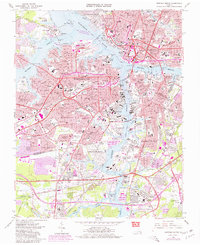
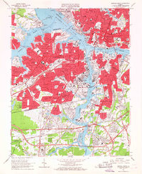
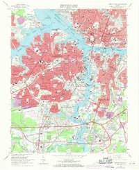
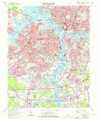
1965 Map of Norfolk South
USGS Topo · Published 1980About this map
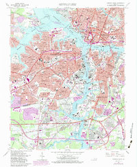
The Elizabeth River anchors this detailed survey of the South Hampton Roads area, where a dense network of neighborhoods like Cradock, Shea Terrace, and Waterview defines the residential core of Portsmouth. The landscape is heavily marked by significant federal and industrial footprints, most notably the sprawling U S Naval Shipyard and the U S Naval Ammunition Depot along the Southern rail lines. This edition, featuring 1980 purple-tinted photorevisions, captures the expansion of urban areas into formerly open ground near Highland-Biltmore and Cavalier Manor.
Find a feature on this map
169 named features on this map. Tap any name to fly to it.
Don’t see what you’re looking for? This feature index may not catch every label — zoom into the map to look around manually.
Map Details
Editions of this 1965 Norfolk South Map
6 editions found

Other maps of this area

1907 · Norfolk
USGS Topo · 1:125,000

1918 · Cape Henry
USGS Topo · 1:62,500

1919 · Cape Henry
USGS Topo · 1:62,500

1921 · Newport News
USGS Topo · 1:62,500

1939 · Moyock
USGS Topo · 1:62,500

1940 · Lake Drummond
USGS Topo · 1:62,500

1944 · Norfolk South
USGS Topo · 1:25,000

1945 · Lake Drummond
USGS Topo · 1:62,500

1946 · Moyock
USGS Topo · 1:62,500

1948 · Norfolk South
USGS Topo · 1:24,000