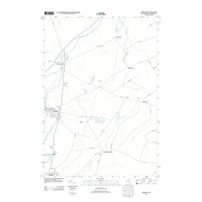
2013 Map of Norfolk
USGS Topo · Published 2013About this map
The Raquette River dictates the layout of this Saint Lawrence County landscape, winding past the village of Norfolk and the hamlet of Raymondville. This 2013 survey reveals a detailed network of rural roads connecting small settlements and family farmsteads throughout the towns of Norfolk and Stockholm. Landmarks of interest for local history include the Visitation Cem and Brookdale Cem, while the course of the river is punctuated by named elevations like Marble Hill and Wilbur Hill. The eastern portion of the map is defined by the winding path of Plum Brook, which flows through the communities of Plumbrook and Brookdale. The infrastructure here, including North Stockholm and Yaleville, reflects a well-established northern New York rural economy centered around the river and regional transit corridors.
Find a feature on this map
74 named features on this map. Tap any name to fly to it.
Don’t see what you’re looking for? This feature index may not catch every label — zoom into the map to look around manually.
Map Details
Editions of this 2013 Norfolk Map
This is the sole edition of this map. No revisions or reprints were ever made.
Other maps of this area

1905 · Waddington
USGS Topo · 1:62,500

1906 · Massena
USGS Topo · 1:62,500

1907 · Massena
USGS Topo · 1:62,500

1908 · Potsdam
USGS Topo · 1:62,500

1910 · Canton
USGS Topo · 1:62,500

1911 · Canton
USGS Topo · 1:62,500

1942 · Chase Mills
USGS Topo · 1:24,000

1942 · Norfolk
USGS Topo · 1:24,000

1942 · Massena
USGS Topo · 1:24,000

1943 · Potsdam
USGS Topo · 1:31,680