
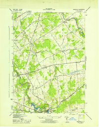
1942 Map of Norfolk
USGS Topo · Published 1961About this map
The Raquette River winds through this northern New York landscape, anchoring a network of mid-century industrial and agricultural settlements. During the early 1940s, the region was defined by a dense intersection of rail lines, including the Norwood and St Lawrence, New York Central, and Rutland railroads. These transit corridors linked the riverside communities of Raymondville, Norfolk, and Norwood, which served as local hubs for commerce and transport.
Find a feature on this map
30 named features on this map. Tap any name to fly to it.
Don’t see what you’re looking for? This feature index may not catch every label — zoom into the map to look around manually.
Map Details
Editions of this 1942 Norfolk Map
This is the sole edition of this map. No revisions or reprints were ever made.
Other maps of this area

1905 · Waddington
USGS Topo · 1:62,500

1906 · Massena
USGS Topo · 1:62,500

1907 · Massena
USGS Topo · 1:62,500

1908 · Potsdam
USGS Topo · 1:62,500

1910 · Canton
USGS Topo · 1:62,500

1911 · Canton
USGS Topo · 1:62,500

1942 · Chase Mills
USGS Topo · 1:24,000

1942 · Massena
USGS Topo · 1:24,000

1943 · Potsdam
USGS Topo · 1:31,680
1943 · Parishville
USGS Topo · 1:31,680