Loading...
Loading map...1926 Map of Normal
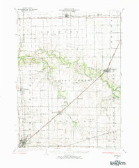
USGS Topo · Published 1984About this map
Normal and Lexington anchor this mid-1920s landscape in McLean County, where the industrial and educational expansion of the era is evident through a dense network of country schools and rail lines. The Chicago and Alton railroad cuts diagonally across the terrain, passing through the village of Towanda, while the Illinois Central serves the western corridor near Hudson. This survey captures the rural educational structure of the time, documenting dozens of named local schoolhouses such as the Little Red Sch and the Buck Creek Sch.
Find a feature on this map
70 named features on this map. Tap any name to fly to it.
Don’t see what you’re looking for? This feature index may not catch every label — zoom into the map to look around manually.
Map Details
Date Portrayed1926
Date Published1984
PublisherU.S. Geological Survey
Map TypeTopographic
Scale1:62,500
Physical Dimensions18 x 21.7 inches
Editions of this 1926 Normal Map
2 editions found

Historical Maps of Bloomington Through Time

Featured Locations
Source Details
SourceU.S. Geological Survey
CopyrightPublic Domain