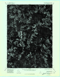
1975 Map of Norridgewock NW
USGS Topo · Published 1980About this map
The Sandy River winds through a heavily wooded and agricultural landscape in Somerset County in this mid-1970s orthophotograph. The imagery captures the winding path of the river as it dominates the northern and western sections of the map, carving through the rural terrain of Starks. To the south, the settlement of Mercer and the smaller locality of East Mercer are visible, connected by a network of local roads that cut through the dense forest cover. The confluence of Bog Stream with larger waterways highlights the drainage patterns of this central Maine region. This specific photographic survey provides a clear view of the field-to-forest ratio and the isolated placement of farmsteads and rural homes during this era, offering a distinct visual record compared to traditional line-drawn topographic maps.
Find a feature on this map
5 named features on this map. Tap any name to fly to it.
Don’t see what you’re looking for? This feature index may not catch every label — zoom into the map to look around manually.
Map Details
Editions of this 1975 Norridgewock NW Map
This is the sole edition of this map. No revisions or reprints were ever made.
Other maps of this area

1894 · Norridgewock
USGS Topo · 1:62,500

1898 · Norridgewock
USGS Topo · 1:62,500

1904 · Anson
USGS Topo · 1:62,500

1924 · Farmington
USGS Topo · 1:62,500

1930 · Kingfield
USGS Topo · 1:48,000

1932 · Kingfield
USGS Topo · 1:62,500

1943 · Norridgewock
USGS Topo · 1:62,500

1948 · Bangor
USGS Topo · 1:250,000

1950 · Lewiston
USGS Topo · 1:250,000

1955 · Anson
USGS Topo · 1:62,500