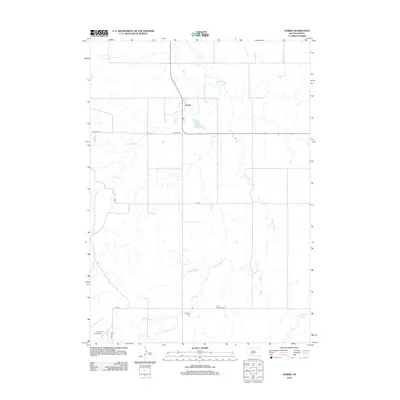
2012 Map of Norris
USGS Topo · Published 2012About this map
Norris serves as the primary settlement on this South Dakota landscape, situated at the intersection of several local routes. The terrain is defined by a dense network of watercourses, most notably the winding Black Pipe Cr which meanders across the eastern half of the quadrangle. For genealogists and local historians, several burial sites are documented across the plains, including Norris Cem, Poor Thunder Cem, and Red Leaf Cem. These landmarks, along with the Red Leaf Campground near Cottonwood Cr, reflect the rural community's geographic focal points. The map also illustrates the drainage patterns of Dry Cr and Swimmer Cr, providing a detailed look at the hydrology of the northern Great Plains in the early 21st century.
Find a feature on this map
14 named features on this map. Tap any name to fly to it.
Don’t see what you’re looking for? This feature index may not catch every label — zoom into the map to look around manually.
Map Details
Editions of this 2012 Norris Map
This is the sole edition of this map. No revisions or reprints were ever made.
Other maps of this area

1955 · Martin
USGS Topo · 1:250,000

1958 · Martin
USGS Topo · 1:250,000

1969 · Norris
USGS Topo · 1:24,000

1969 · Eagle Mans Butte
USGS Topo · 1:24,000

1969 · Parmelee NE
USGS Topo · 1:24,000

1969 · Parmelee
USGS Topo · 1:24,000

1980 · Kadoka
USGS Topo · 1:100,000

1981 · Cedar Butte
USGS Topo · 1:25,000

1981 · Long Valley
USGS Topo · 1:25,000

1981 · Blackpipe
USGS Topo · 1:25,000