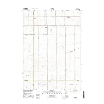
2015 Map of Norris
USGS Topo · Published 2015About this map
Norris serves as the primary settlement on this South Dakota prairie landscape, situated at the intersection of Long Valley Rd and Black Pipe Lp. The map reveals a land defined by its cultural sites and the drainage patterns of the northern plains, particularly where Dry Cr and Black Pipe Cr wind across the terrain. These watercourses are flanked by local markers of history and community, including several small burial grounds. Genealogy researchers will find the locations of Norris Cem, Red Leaf Cem, and Poor Thunder Cem precisely marked. The map also delineates the complex jurisdictional boundaries of the region, where Jackson Co, Mellette Co, Bennett Co, and Todd Co all meet, illustrating how administrative lines overlay the natural flow of Cottonwood Cr and Swimmer Cr.
Find a feature on this map
27 named features on this map. Tap any name to fly to it.
Don’t see what you’re looking for? This feature index may not catch every label — zoom into the map to look around manually.
Map Details
Editions of this 2015 Norris Map
This is the sole edition of this map. No revisions or reprints were ever made.
Other maps of this area

1955 · Martin
USGS Topo · 1:250,000

1958 · Martin
USGS Topo · 1:250,000

1969 · Norris
USGS Topo · 1:24,000

1969 · Eagle Mans Butte
USGS Topo · 1:24,000

1969 · Parmelee NE
USGS Topo · 1:24,000

1969 · Parmelee
USGS Topo · 1:24,000

1980 · Kadoka
USGS Topo · 1:100,000

1981 · Cedar Butte
USGS Topo · 1:25,000

1981 · Long Valley
USGS Topo · 1:25,000

1981 · Blackpipe
USGS Topo · 1:25,000