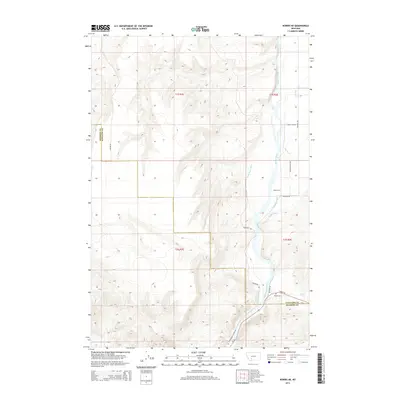
2014 Map of Norris NE
USGS Topo · Published 2014About this map
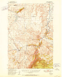
The Madison River carves a deep valley through this portion of Gallatin and Madison Counties, defining a landscape shaped by both geology and irrigation. The river's eastern bank is marked by a sophisticated network of water engineering, including the Dell Ditch, Greene Ranch Ditch, and Hutchinson Ditch, which redirect water to the surrounding benchlands. Near the river's bend, Blacks Ford serves as a notable crossing point, accompanied by the Black Cem nearby. This area is characterized by the transition from the high-desert terrain of the Madison Range foothills down to the river bottoms. Significant tributaries such as Elk Cr and Cold Spring Cr join the main flow, while road networks like MT-84 and Beartrap Rd provide access through the complex canyon topography, particularly along the N Beartrap Canyon Rd.
Find a feature on this map
24 named features on this map. Tap any name to fly to it.
Don’t see what you’re looking for? This feature index may not catch every label — zoom into the map to look around manually.
Map Details
Editions of this 2014 Norris NE Map
This is the sole edition of this map. No revisions or reprints were ever made.
Other maps of this area
1888 · Three Forks
USGS Topo · 1:250,000
1894 · Three Forks
USGS Topo · 1:250,000
1895 · Three Forks
USGS Topo · 1:250,000

1947 · Bozeman
USGS Topo · 1:250,000

1948 · Bozeman
USGS Topo · 1:250,000
1949 · Anceney
USGS Topo · 1:62,500
1949 · Manhattan
USGS Topo · 1:62,500
1949 · Norris
USGS Topo · 1:62,500
1950 · Three Forks
USGS Topo · 1:62,500
1951 · Norris
USGS Topo · 1:62,500