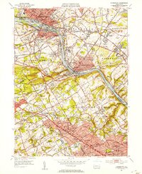
1952 Map of Norristown
USGS Topo · Published 1954About this map
Norristown and Conshohocken anchor this industrial and academic corridor along the Schuylkill River in the early 1950s. The landscape is a dense network of established boroughs and emerging suburban tracts, where the Pennsylvania RR and Reading RR parallel the riverbanks, serving heavy industries like those in Swedeland and Bridgeport. This era shows the region's prominent educational infrastructure in detail, featuring the sprawling campuses of Villanova College, Bryn Mawr College, and Haverford College along the Main Line.
Find a feature on this map
120 named features on this map. Tap any name to fly to it.
Don’t see what you’re looking for? This feature index may not catch every label — zoom into the map to look around manually.
Map Details
Editions of this 1952 Norristown Map
2 editions found
Other maps of this area

1891 · Philadelphia
USGS Topo · 1:62,500

1893 · Germantown
USGS Topo · 1:62,500

1894 · Chester
USGS Topo · 1:62,500

1894 · Philadelphia
USGS Topo · 1:62,500

1894 · Norristown
USGS Topo · 1:62,500

1894 · Germantown
USGS Topo · 1:62,500

1895 · Norristown
USGS Topo · 1:62,500

1896 · Germantown
USGS Topo · 1:62,500

1896 · Philadelphia
USGS Topo · 1:62,500

1896 · Norristown
USGS Topo · 1:62,500
Featured Places
- Philadelphia, PA
- Norristown, PA
- Radnor Township, PA
- King of Prussia, Upper Merion Township
- Whitemarsh Township, PA