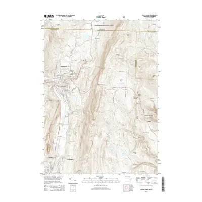
2015 Map of North Adams
USGS Topo · Published 2015About this map
The North Adams urban corridor sits at a critical intersection of industry and topography, where the Hoosic River carves a path between the Green Mountains and the Hoosac Range. This 2015 survey details the dense neighborhood structures of Houghtonville and Briggsville alongside institutional landmarks like the Massachusetts Coll of Liberal Arts. A notable geological feature, the Natural Bridge of New England, is preserved just north of the city center.
Find a feature on this map
125 named features on this map. Tap any name to fly to it.
Don’t see what you’re looking for? This feature index may not catch every label — zoom into the map to look around manually.
Map Details
Editions of this 2015 North Adams Map
This is the sole edition of this map. No revisions or reprints were ever made.
Other maps of this area

1886 · Greylock
USGS Topo · 1:62,500

1886 · Hawley
USGS Topo · 1:62,500

1889 · Wilmington
USGS Topo · 1:62,500

1890 · Hawley
USGS Topo · 1:62,500

1891 · Wilmington
USGS Topo · 1:62,500

1891 · Greylock
USGS Topo · 1:62,500

1893 · Greylock
USGS Topo · 1:62,500

1894 · Hawley
USGS Topo · 1:62,500

1898 · Bennington
USGS Topo · 1:62,500

1898 · Greylock
USGS Topo · 1:62,500