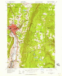
1944 Map of North Adams
USGS Topo · Published 1958About this map
Industrial corridors along the Hoosic River anchor this 1944 survey, which highlights the dense urban core of North Adams and its surrounding satellite settlements. The manufacturing history of the region is evident in the rail-served neighborhoods of Zylonite, Renfrew, and the northern edge of Adams, all connected by the Boston and Maine railroad. East of the river, the terrain rises sharply toward the Hoosac Range, where the engineering marvel of the Boston Central Shaft marks a critical point in the rail tunnel beneath the mountains.
Find a feature on this map
50 named features on this map. Tap any name to fly to it.
Don’t see what you’re looking for? This feature index may not catch every label — zoom into the map to look around manually.
Map Details
Editions of this 1944 North Adams Map
This is the sole edition of this map. No revisions or reprints were ever made.
Other maps of this area

1886 · Greylock
USGS Topo · 1:62,500

1886 · Hawley
USGS Topo · 1:62,500

1889 · Wilmington
USGS Topo · 1:62,500

1890 · Hawley
USGS Topo · 1:62,500

1891 · Wilmington
USGS Topo · 1:62,500

1891 · Greylock
USGS Topo · 1:62,500

1893 · Greylock
USGS Topo · 1:62,500

1894 · Hawley
USGS Topo · 1:62,500

1898 · Bennington
USGS Topo · 1:62,500

1898 · Greylock
USGS Topo · 1:62,500