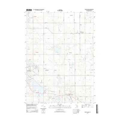
2014 Map of North Adams
USGS Topo · Published 2014About this map
The village of North Adams sits at the intersection of N Adams Rd and W Main St, serving as a focal point for this agrarian landscape in northern Hillsdale County. The terrain is defined by a dense network of glacial lakes and managed waterways, including the Saint Joseph River and various rural infrastructure projects like the Williams Drain and Otto Drain. To the southwest, the city of Hillsdale borders Mill Pond and the Hillsdale Municipal Airport, reflecting the regional shift toward aviation and expanded municipal services. Local heritage is preserved in numerous burial grounds scattered across the townships, such as N Lawn Cem and E Hill Cem. The southern portion of the map is dominated by the sprawling Baw Beese Lake, a significant water body connected to the headwaters of the S Br Saint Joseph River, illustrating the importance of these lake systems to the local hydrology and community development.
Find a feature on this map
107 named features on this map. Tap any name to fly to it.
Don’t see what you’re looking for? This feature index may not catch every label — zoom into the map to look around manually.
Map Details
Editions of this 2014 North Adams Map
This is the sole edition of this map. No revisions or reprints were ever made.
Other maps of this area
1935 · Jackson
USGS Topo · 1:48,000
1939 · Jackson
USGS Topo · 1:62,500
1948 · Spring Arbor
USGS Topo · 1:62,500
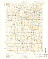
1949 · Spring Arbor
USGS Topo · 1:62,500
1953 · Fort Wayne
USGS Topo · 1:250,000
1956 · Fort Wayne
USGS Topo · 1:250,000
1958 · Grand Rapids
USGS Topo · 1:250,000
1959 · Hillsdale
USGS Topo · 1:24,000
1959 · Reading
USGS Topo · 1:24,000
1959 · North Adams
USGS Topo · 1:24,000