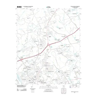
2011 Map of North Augusta
USGS Topo · Published 2011About this map
Sweetwater Branch and Hightower Creek wind through a dense network of suburban expansion and planned communities in this early 21st-century landscape. The map reveals the intricate residential development surrounding the core of North Augusta, featuring numerous named neighborhoods such as Pinewood Plantation, Ascaga Heights, and Martintowne. This period of growth is defined by a heavy concentration of engineered water features, including Mathis Lake, Laurel Lakes, and various unnamed dams like South Carolina Noname 02061.
Find a feature on this map
228 named features on this map. Tap any name to fly to it.
Don’t see what you’re looking for? This feature index may not catch every label — zoom into the map to look around manually.
Map Details
Editions of this 2011 North Augusta Map
This is the sole edition of this map. No revisions or reprints were ever made.
Other maps of this area

1892 · Mc Cormick
USGS Topo · 1:125,000

1912 · Mc Cormick
USGS Topo · 1:125,000

1920 · Clarks Hill
USGS Topo · 1:48,000

1921 · Augusta
USGS Topo · 1:62,500

1921 · Clarks Hill
USGS Topo · 1:62,500

1922 · Hephzibah
USGS Topo · 1:62,500

1923 · Warrenville
USGS Topo · 1:48,000

1928 · Warrenville
USGS Topo · 1:62,500

1941 · Clarks Hill
USGS Topo · 1:62,500

1942 · Clarks Hill
USGS Topo · 1:62,500