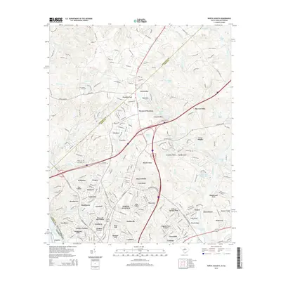
2014 Map of North Augusta
USGS Topo · Published 2014About this map
North Augusta and the surrounding borderlands of South Carolina and Georgia are defined by the winding course of the Savannah River and the industrial heritage of the Augusta Canal. This mid-2010s survey reveals a landscape of dense residential expansion and established neighborhoods, from the historic core near the river to suburban developments like Belvedere, Shannon, and Pinewood Plantation. The terrain rises toward the north at Big Cone Ridge, while the drainage of Sweetwater Br and Horse Creek shapes the local topography. Genealogists will find several notable burial sites including Sweetwater Cem and Hammond Cem. The map illustrates the modern transition of the area, where older crossroads like Sweetwater meet newer planned communities such as Country Place and Windtree, all while maintaining the vital water corridors that once fueled the region's early growth.
Find a feature on this map
85 named features on this map. Tap any name to fly to it.
Don’t see what you’re looking for? This feature index may not catch every label — zoom into the map to look around manually.
Map Details
Editions of this 2014 North Augusta Map
This is the sole edition of this map. No revisions or reprints were ever made.
Other maps of this area

1892 · Mc Cormick
USGS Topo · 1:125,000

1912 · Mc Cormick
USGS Topo · 1:125,000

1920 · Clarks Hill
USGS Topo · 1:48,000

1921 · Augusta
USGS Topo · 1:62,500

1921 · Clarks Hill
USGS Topo · 1:62,500

1922 · Hephzibah
USGS Topo · 1:62,500

1923 · Warrenville
USGS Topo · 1:48,000

1928 · Warrenville
USGS Topo · 1:62,500

1941 · Clarks Hill
USGS Topo · 1:62,500

1942 · Clarks Hill
USGS Topo · 1:62,500