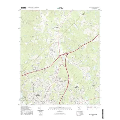
2017 Map of North Augusta
USGS Topo · Published 2017About this map
North Augusta and the surrounding borderlands of South Carolina and Georgia are defined by the dense suburbanization and complex hydrological network of the mid-2010s. The landscape is characterized by established residential developments such as Belvedere, Murphys Estates, and Bradleyville that cluster north of the Savannah River. This era shows a significant concentration of memorial and spiritual sites, including Sweetwater Cem, Hammond Cem, and Pineview Memorial Gardens, which serve as vital landmarks for local genealogical research.
Find a feature on this map
248 named features on this map. Tap any name to fly to it.
Don’t see what you’re looking for? This feature index may not catch every label — zoom into the map to look around manually.
Map Details
Editions of this 2017 North Augusta Map
This is the sole edition of this map. No revisions or reprints were ever made.
Other maps of this area

1892 · Mc Cormick
USGS Topo · 1:125,000

1912 · Mc Cormick
USGS Topo · 1:125,000

1920 · Clarks Hill
USGS Topo · 1:48,000

1921 · Augusta
USGS Topo · 1:62,500

1921 · Clarks Hill
USGS Topo · 1:62,500

1922 · Hephzibah
USGS Topo · 1:62,500

1923 · Warrenville
USGS Topo · 1:48,000

1928 · Warrenville
USGS Topo · 1:62,500

1941 · Clarks Hill
USGS Topo · 1:62,500

1942 · Clarks Hill
USGS Topo · 1:62,500