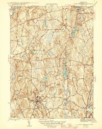
1946 Map of North Brookfield
USGS Topo · Published 1946About this map
North Brookfield serves as the primary hub of this mid-century survey, situated at a busy intersection of routes including the New Braintree Road and Barre Road. The landscape is characterized by a dense concentration of hills, such as Tower Hill and Tarbell Hill, which dictate the winding paths of the local infrastructure. The Boston and Albany RR cuts through the southern portion of the area near Hillsville, illustrating the rail-dependent economy that connected these Worcester County townships to broader markets.
Find a feature on this map
51 named features on this map. Tap any name to fly to it.
Don’t see what you’re looking for? This feature index may not catch every label — zoom into the map to look around manually.
Map Details
Editions of this 1946 North Brookfield Map
2 editions found
Other maps of this area

1885 · Worcester
USGS Topo · 1:62,500

1886 · Worcester
USGS Topo · 1:62,500

1887 · Brookfield
USGS Topo · 1:62,500

1887 · Barre
USGS Topo · 1:62,500

1889 · Webster
USGS Topo · 1:62,500

1889 · Barre
USGS Topo · 1:62,500

1890 · Brookfield
USGS Topo · 1:62,500

1892 · Webster
USGS Topo · 1:62,500

1892 · Worcester
USGS Topo · 1:62,500

1893 · Brookfield
USGS Topo · 1:62,500