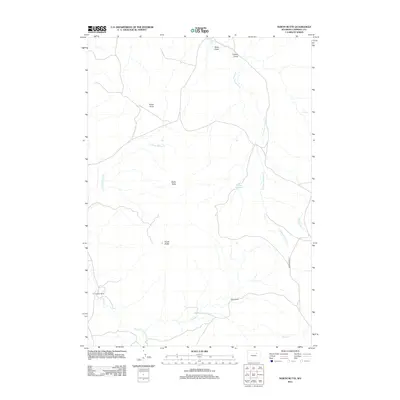
2012 Map of North Butte
USGS Topo · Published 2012About this map
North Butte and Dome Butte dominate this Campbell County landscape, serving as primary vertical landmarks in a region defined by high-plains drainage systems. Ranching footprints are evident through established sites like the Christensen Ranch in the southwest and the Pfister Ranch further east, illustrating the importance of livestock operations in this arid environment. The map details an intricate network of seasonal waterways, including the headwaters of S Prong Pumpkin Cr and several branches of Willow Creek, such as N Prong Willow Cr and Dry Willow Cr. The presence of Dresher Reservoir and Y Spring highlights the critical infrastructure required for water management on these vast rangelands. Further north, features like Pistol Point and drainage draws including Bons Draw and Collins Draw provide specific orientation points for understanding the local topography and historical land use patterns.
Find a feature on this map
15 named features on this map. Tap any name to fly to it.
Don’t see what you’re looking for? This feature index may not catch every label — zoom into the map to look around manually.
Map Details
Editions of this 2012 North Butte Map
This is the sole edition of this map. No revisions or reprints were ever made.
Other maps of this area

1953 · Dry Fork Ranch
USGS Topo · 1:24,000

1953 · Fort Reno SE
USGS Topo · 1:24,000

1953 · Savageton
USGS Topo · 1:24,000

1953 · Fats Draw
USGS Topo · 1:24,000

1953 · South Butte
USGS Topo · 1:24,000

1953 · The Nipple
USGS Topo · 1:24,000

1953 · Rolling Pin Ranch
USGS Topo · 1:24,000

1953 · North Butte
USGS Topo · 1:24,000

1955 · Newcastle
USGS Topo · 1:250,000

1955 · Arminto
USGS Topo · 1:250,000