
1953 Map of Fats Draw
USGS Topo · Published 1954About this map
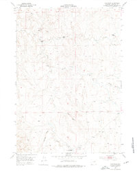
Isolated ranching operations and natural drainage systems define this mid-century look at the Campbell County ranchlands. The landscape is dominated by the complex network of the North Prong, Middle Prong, and South Prong of the local creeks, punctuated by vital water sources like Artesian Well and various Water Holes. Established homesteads such as Wormwood Ranch and Saunders Ranch are connected by a web of unimproved dirt roads, while the presence of the Gilkie Ranch (Aban'd) suggests the shifting nature of rural settlement in the high plains. A small Airstrip (Private) near the Pumpkin Creek drainage indicates the necessity of aerial transport for these far-flung operations. The topography is further marked by prominent landmarks like The Nipple and deep seasonal cuts including Fats Draw and Hartzog Draw.
Find a feature on this map
19 named features on this map. Tap any name to fly to it.
Don’t see what you’re looking for? This feature index may not catch every label — zoom into the map to look around manually.
Map Details
Editions of this 1953 Fats Draw Map
2 editions found
Other maps of this area

1953 · Fort Reno SE
USGS Topo · 1:24,000

1953 · Savageton
USGS Topo · 1:24,000

1953 · The Nipple
USGS Topo · 1:24,000

1953 · North Butte
USGS Topo · 1:24,000

1954 · Gillette
USGS Topo · 1:250,000

1955 · Newcastle
USGS Topo · 1:250,000

1955 · Sheridan
USGS Topo · 1:250,000

1955 · Arminto
USGS Topo · 1:250,000

1955 · Gillette
USGS Topo · 1:250,000

1958 · Gillette
USGS Topo · 1:250,000