1955 Map of Gillette
USGS Topo · Published 1976About this map
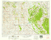
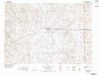
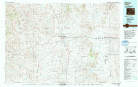
The Devils Tower National Monument stands as a focal point in this 1955 survey of northeastern Wyoming and its transition into the Black Hills. This region, revised through the mid-1970s, illustrates a landscape defined by both massive geological features and a growing energy economy. The coal and power infrastructure is evident near Gillette at Wyodak, where a power plant and extensive oil fields appear alongside the Burlington Northern railroad. To the east, the Bear Lodge Mountains and Black Hills National Forest dominate the terrain, surrounding settlements like Sundance and Aladdin. Local social geography is recorded through landmarks such as the Pleasantdale Community Building and the Keyhole Reservoir on the Belle Fourche River, providing a look at rural life and land use before the expansion of modern industrial footprints.
Find a feature on this map
132 named features on this map. Tap any name to fly to it.
Don’t see what you’re looking for? This feature index may not catch every label — zoom into the map to look around manually.
Map Details
Editions of this 1955 Gillette Map
This is the sole edition of this map. No revisions or reprints were ever made.
Historical Maps of Gillette Through Time
6 maps found