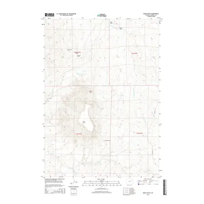
2015 Map of North Butte
USGS Topo · Published 2015About this map
Pumpkin Buttes dominate this high plains landscape in southern Campbell County, providing a series of prominent topographic landmarks including North Butte and Dome Butte. This 2015 survey reveals an arid ranching and energy landscape characterized by a network of drainage features like S Prong Pumpkin Cr and Prong Willow Cr. Water management is evident through the inclusion of the Dresher Reservoir and Rodabaugh Reservoir, essential features for local land use in this part of Wyoming. The map also records several family-named landmarks and geographic features such as Pistol Point, Hartzog Draw, and Heidt Draw, which offer clues to the ranching history and local nomenclature of the region. Access is primarily limited to rugged tracks and Christensen Rd, illustrating the low population density and expansive nature of this section of the Powder River Basin.
Find a feature on this map
19 named features on this map. Tap any name to fly to it.
Don’t see what you’re looking for? This feature index may not catch every label — zoom into the map to look around manually.
Map Details
Editions of this 2015 North Butte Map
This is the sole edition of this map. No revisions or reprints were ever made.
Other maps of this area

1953 · Dry Fork Ranch
USGS Topo · 1:24,000

1953 · Fort Reno SE
USGS Topo · 1:24,000

1953 · Savageton
USGS Topo · 1:24,000

1953 · Fats Draw
USGS Topo · 1:24,000

1953 · South Butte
USGS Topo · 1:24,000

1953 · The Nipple
USGS Topo · 1:24,000

1953 · Rolling Pin Ranch
USGS Topo · 1:24,000

1953 · North Butte
USGS Topo · 1:24,000

1955 · Newcastle
USGS Topo · 1:250,000

1955 · Arminto
USGS Topo · 1:250,000