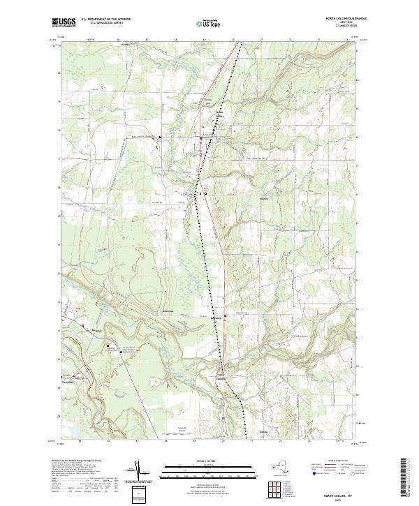
2023 Map of North Collins
USGS Topo · Published 2023About this map
North Collins serves as the central hub of this Erie County landscape, where the primary north-south corridor of Main St connects a series of hamlets and rural settlements. The topography is defined by the winding course of Big Sister Creek and the notable gorge of Franklin Gulf to the north, while the southern boundary follows the meanders of Cattaraugus Creek. Local history is deeply embedded in the numerous small burial grounds and meeting houses scattered across the township, including the North Collins Quaker Meeting House Cem and the Huson Cem. The transition from the more developed village of North Collins to the outlying areas of Lawtons, Shirley, and Iroquois reflects a traditional Western New York pattern of agrarian settlement. To the southwest, the village of Versailles sits near the junction of several historical routes, while the Gowanda Airport represents the more modern infrastructure of the region.
Find a feature on this map
94 named features on this map. Tap any name to fly to it.
Don’t see what you’re looking for? This feature index may not catch every label — zoom into the map to look around manually.
Map Details
Editions of this 2023 North Collins Map
This is the sole edition of this map. No revisions or reprints were ever made.
Other maps of this area

1899 · Silver Creek
USGS Topo · 1:62,500

1900 · Cherry Creek
USGS Topo · 1:62,500

1905 · Eden
USGS Topo · 1:62,500

1907 · Eden
USGS Topo · 1:62,500

1923 · Cattaraugus
USGS Topo · 1:62,500

1938 · Cattaraugus
USGS Topo · 1:62,500

1941 · Cattaraugus
USGS Topo · 1:62,500

1941 · Cherry Creek
USGS Topo · 1:62,500

1944 · Eden
USGS Topo · 1:62,500

1944 · North Collins
USGS Topo · 1:31,680