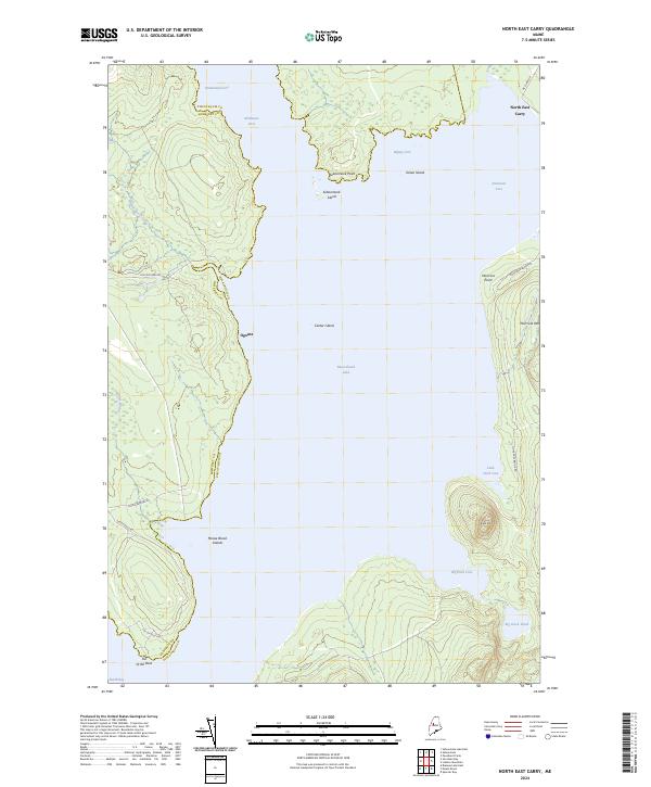
2024 Map of North East Carry
USGS Topo · Published 2024About this map
Moosehead Lake dominates this northern Maine landscape, where the historical portage at North East Carry connects the great lake toward the West Branch of the Penobscot River. The terrain is defined by dramatic water boundaries and timberlands, including the distinctive peninsula known as the Toe of the Boot and the elevations of Eagle Mtn and Norcross Mtn to the east. The map preserves the path of the Old Middlesex Rd, a route reflecting the area's legacy as a gateway for nineteenth-century sporting and logging. Small island features like Center Island and Seboomook Island are plotted within the expansive waters, while the settlement at Ogontz and various coves such as Bigney Cove and Northeast Cove highlight the irregular shoreline that has long guided travelers through the Maine North Woods.
Find a feature on this map
29 named features on this map. Tap any name to fly to it.
Don’t see what you’re looking for? This feature index may not catch every label — zoom into the map to look around manually.
Map Details
Editions of this 2024 North East Carry Map
This is the sole edition of this map. No revisions or reprints were ever made.
Other maps of this area

1920 · Moosehead Lake
USGS Topo · 1:62,500

1921 · Brassua Lake
USGS Topo · 1:62,500

1922 · Moosehead Lake
USGS Topo · 1:62,500

1923 · Brassua Lake
USGS Topo · 1:62,500

1930 · Moosehead Lake
USGS Topo · 1:62,500

1944 · Brassua Lake
USGS Topo · 1:62,500

1944 · Moosehead Lake
USGS Topo · 1:62,500

1954 · Seboomook Lake
USGS Topo · 1:62,500

1954 · North East Carry
USGS Topo · 1:62,500

1954 · Millinocket
USGS Topo · 1:250,000
Featured Places
- Northeast Carry Township, ME
- Big W Township, ME
- East Middlesex Canal Grant Township, ME
- Ogontz, Big W Township
- North East Carry, Northeast Carry Township