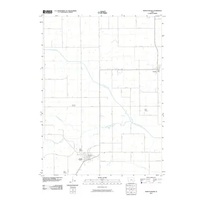
2010 Map of North English
USGS Topo · Published 2010About this map
North English and Parnell anchor this agricultural landscape in eastern Iowa, where the convergence of several waterways dictates the local geography. The North English River and Middle English River meander across the terrain, joined by smaller tributaries like Gritter Creek and Little Creek. For genealogists, the map is particularly useful for locating several burial grounds including North English Cemetery, Saint Patricks Cemetery, Yankee Point Cemetery, and Campbell Cemetery, which provide clues to the settlement patterns of families in this section of Iowa County. The infrastructure is defined by a grid of rural routes such as 335th St and Keokuk Iowa, alongside essential civic landmarks like the North English Post Office and Parnell Post Office. This survey provides a clear view of the rural township structure and the enduring layout of these farming communities in the early 21st century.
Find a feature on this map
27 named features on this map. Tap any name to fly to it.
Don’t see what you’re looking for? This feature index may not catch every label — zoom into the map to look around manually.
Map Details
Editions of this 2010 North English Map
This is the sole edition of this map. No revisions or reprints were ever made.
Other maps of this area

1891 · Oxford
USGS Topo · 1:62,500

1894 · Oxford
USGS Topo · 1:62,500

1903 · Fairfax
USGS Topo · 1:125,000

1954 · Des Moines
USGS Topo · 1:250,000

1956 · Des Moines
USGS Topo · 1:250,000

1957 · Des Moines
USGS Topo · 1:250,000

1958 · Davenport
USGS Topo · 1:250,000

1961 · Davenport
USGS Topo · 1:250,000

1962 · Davenport
USGS Topo · 1:250,000

1965 · Keswick
USGS Topo · 1:24,000