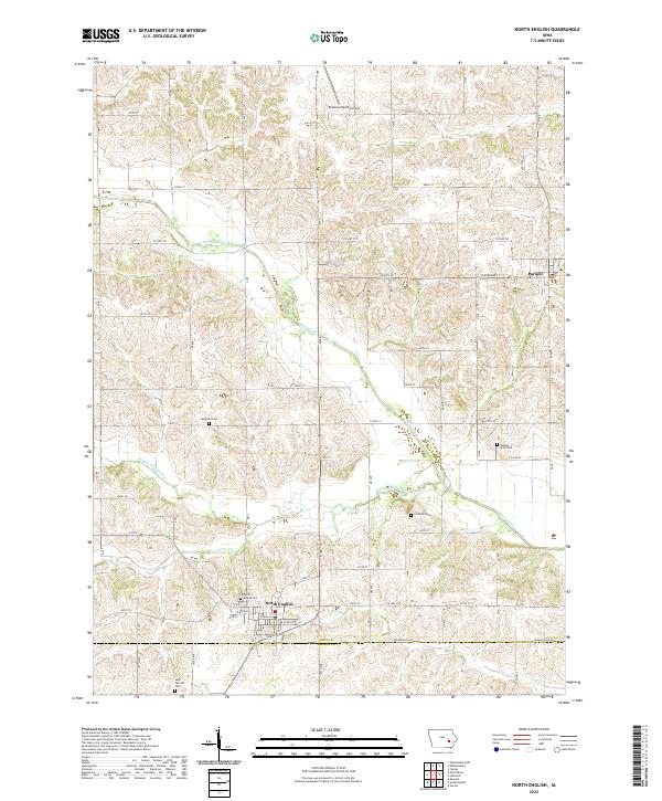
2022 Map of North English
USGS Topo · Published 2022About this map
North English and Parnell anchor this landscape along the border of Iowa and Keokuk counties, where the terrain is deeply etched by the branching paths of the North English River, Middle English River, and several smaller tributaries like Gritter Cr. This 2022 survey captures the area's agricultural character, defined by a rigid grid of rural roads such as Co HWY f52 and Keokuk Iowa Rd. Genealogists and local historians will find significant detail in the distribution of family and community burial grounds across the townships, including North English Cem, Saint Patricks Cem, and the more remote Yankee Point Cem. The presence of the Bellevue Farms Airport and the concentrated street plan of North English, featuring W Broad St and E Clark St, provide a clear view of the modern infrastructure supporting these longstanding eastern Iowa settlements.
Find a feature on this map
29 named features on this map. Tap any name to fly to it.
Don’t see what you’re looking for? This feature index may not catch every label — zoom into the map to look around manually.
Map Details
Editions of this 2022 North English Map
This is the sole edition of this map. No revisions or reprints were ever made.
Other maps of this area

1891 · Oxford
USGS Topo · 1:62,500

1894 · Oxford
USGS Topo · 1:62,500

1903 · Fairfax
USGS Topo · 1:125,000

1954 · Des Moines
USGS Topo · 1:250,000

1956 · Des Moines
USGS Topo · 1:250,000

1957 · Des Moines
USGS Topo · 1:250,000

1958 · Davenport
USGS Topo · 1:250,000

1961 · Davenport
USGS Topo · 1:250,000

1962 · Davenport
USGS Topo · 1:250,000

1965 · Keswick
USGS Topo · 1:24,000