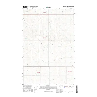
2017 Map of North Fork Horse Creek
USGS Topo · Published 2017About this map
N Fork Horse Cr and its winding tributaries define this section of the Montana high plains in McCone County. The drainage network, including E Fork Prairie Elk Cr and Middle Fork McGuire Cr, illustrates the deeply dissected terrain characteristic of the region north of the Missouri River. Settlement patterns in this 2017 survey are dictated by the land's hydrology and the Public Land Survey System, with few paved surfaces intersecting the expansive grazing lands. Navigation and access are primarily managed through the corridor of Weldon Rd, which follows the higher ground alongside S Weldon Loop and Dinger Rd. The map provides a clear record of modern ranching boundaries and the localized infrastructure required to maintain this sparsely populated landscape.
Find a feature on this map
10 named features on this map. Tap any name to fly to it.
Don’t see what you’re looking for? This feature index may not catch every label — zoom into the map to look around manually.
Map Details
Editions of this 2017 North Fork Horse Creek Map
This is the sole edition of this map. No revisions or reprints were ever made.
Other maps of this area

1954 · Glendive
USGS Topo · 1:250,000

1957 · Glendive
USGS Topo · 1:250,000

1958 · Glendive
USGS Topo · 1:250,000

1982 · Circle
USGS Topo · 1:100,000

1983 · Youngquist Mine
USGS Topo · 1:24,000
1983 · Figure Eight Creek
USGS Topo · 1:24,000

1983 · Brockway NE
USGS Topo · 1:24,000

1983 · Haynie Reservoir
USGS Topo · 1:24,000

1983 · Pedigo Coulee
USGS Topo · 1:24,000

1983 · North Fork Horse Creek
USGS Topo · 1:24,000